Introducing ArcGIS Server
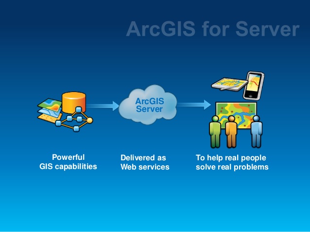
ArcGIS Server is a platform for building large-scale geographic information systems (GIS), in which GIS applications are centrally managed, support multiple users, integrate many powerful GIS functions and are built on industry standards. ArcGIS Server manages geographic data sources such as maps, spatial data …
This is a distributed system consisting of many components that can be deployed on many different machines. Each of these components holds a specific role in the management process, operating or stopping operating, balancing the resources provided to one or more servers. ArcGIS Server components include:
GIS Server: Stores and runs server applications. The GIS server consists of a SOM (Server Object Manager) server and one or more other SOC (Server Object Containers) servers.
Web Server: Hosts Web applications and services that use components running on the GIS server.
Web Browser: Used to connect to Web applications running on the Web server.
Desktop Applications: Connect via Hypertext Transfer Protocol (HTTP) to Web services running on the Web server or connect directly to the GIS server via a LAN or WAN environment.
Main Features of ArcGIS Server
1. Standard GIS Framework
ArcGIS Server provides a standard framework for developing applications on the GIS server. The most popular GIS software suites today (ArcView®, ArcEditorTM, ArcInfo®) are also built on the same platform. ArcGIS Server is not only scalable but also provides many powerful functions that allow programmers to save time researching and building GIS functions from scratch.
2. Low cost
ArcGIS Server is capable of supporting large applications such as building Web GIS, running on multiple servers, supporting multiple users. ADF technology has no copyright restrictions. This allows server applications to run on multiple Web servers, thereby reducing costs, depending only on the number of users.
3. Web applications
ArcGIS Server provides a set of Web controls. These Web controls simplify the process of building and integrating maps into Web applications, helping programmers focus on building GIS functions according to their purposes.
4. Web application templates
ArcGIS Server provides quite a few Web application templates. Developers can use these templates in conjunction with Web controls to create their own Web applications or use them as reference.
5. Cross-platform support
ArcGIS Server ADF for Java runs on many UNIX-based operating systems and supports a wide range of Web servers.
GIS Server itself is supported for Windows, Sun Solaris, and Red Hat Linux. ADF for .NET only runs on some Windows operating systems. See http://support.esri.com for more information on supported operating systems.
6. Support for multiple programming languages
ArcGIS Server supports multiple programming languages, including .NET and Java, for developing Web applications and services. Using COM and .NET allows ArcGIS Server to be extended with custom features, and COM, .NET, Java, and C++ are also used to build Desktop client applications. This allows objects to be programmed using multiple tools and programmers do not necessarily need to know multiple programming languages.
7. ArcGIS Server Extensions
The ArcGIS Server developer toolkit also includes the ArcGIS 3D AnalystTM, ArcGIS Spatial Analyst, and ArcGIS StreetMapTM extensions
8. Provides a wealth of resources for programmers.
The ArcGIS Server developer toolkit provides a help system based on object model diagrams (OMDs), Web application templates, and sample programming code that makes it easy for programmers to access and use.
Why use ArcGIS Server
ArcGIS Server allows programmers and system designers to deploy centralized GIS management. This will reduce costs for GIS users and can expand user support capabilities, saving on software installation costs on each machine. Along with its support for Web services, ArcGIS Server can integrate seamlessly with other information systems such as relational databases, Web servers, and large servers.
ArcGIS Server is an addition to ESRI’s family of server-based applications: ArcIMS, ArcSDE, and ArcGIS Server. ArcIMS enables powerful Web-based map and metadata publishing, and ArcGIS Server centrally manages